As long as Americans continue to suffer and die from the coronavirus pandemic, we will need to exercise an abundance of caution, regardless of what some might tell us. In the map below, you will find which counties in the United States reported new coronavirus deaths (shown in red) and, if there were no additional deaths, which counties reported new coronavirus positive cases (shown in orange) during the most recent reporting day. I will update this map each day until the pandemic has ended. Be safe!
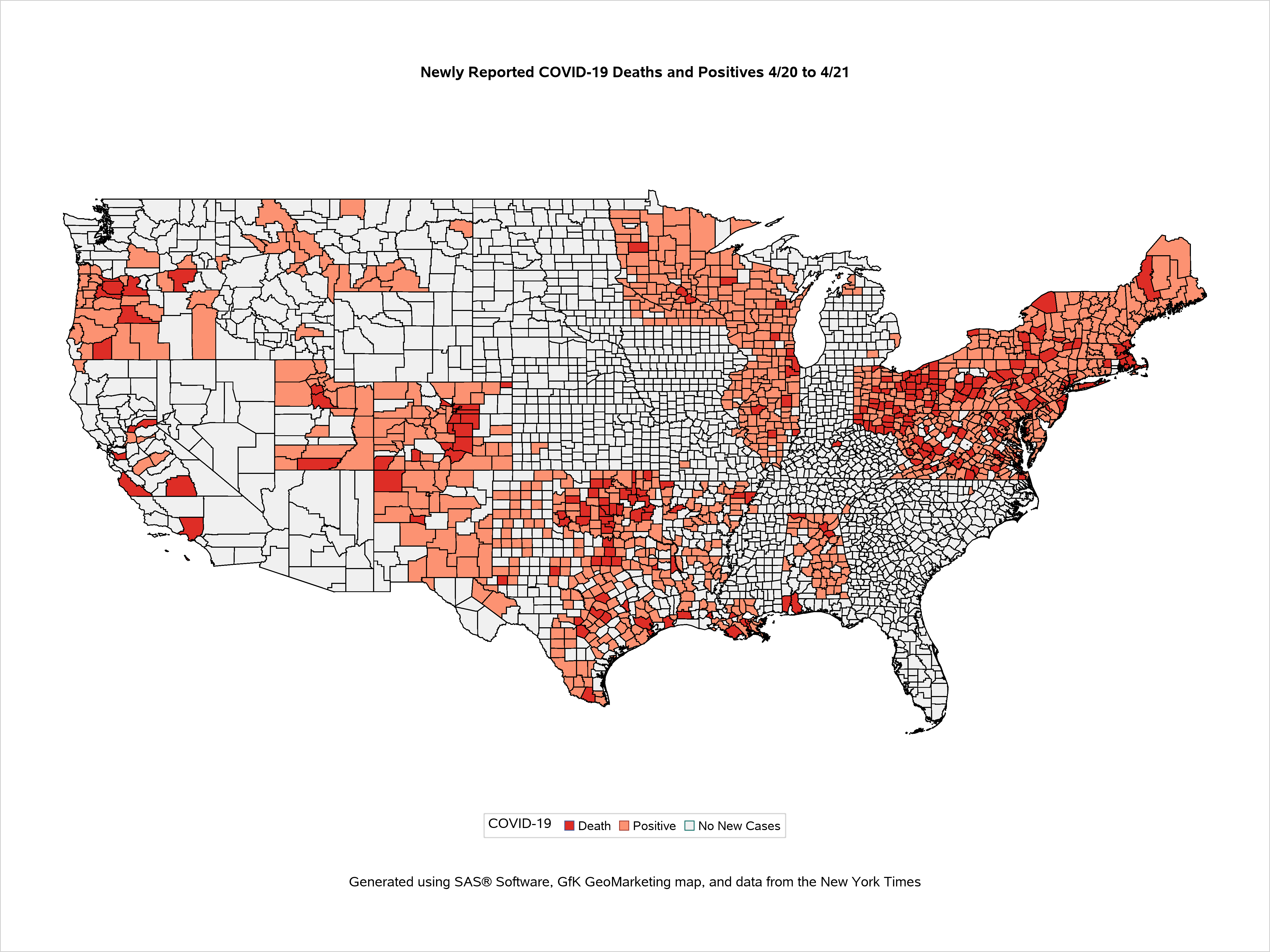

I continue to update the COVID-19 U.S. map each day in the early afternoon. You can bookmark a direct link to the map at https://skythisweek.info/covid19map.png.
I continue to update the COVID-19 U.S. map each day in the early afternoon. You can bookmark a direct link to the map at https://skythisweek.info/covid19map.png.
Only 13 counties in the continental United States have no recorded cases of COVID-19 as of this date. They are in 8 states. Here they are.
Kiowa County, Colorado, population 1,406
Carter County, Montana, population 1,238
Petroleum County, Montana, population 513
Blaine County, Nebraska, population 476
Grant County, Nebraska, population 649
Hayes County, Nebraska, population 893
Esmeralda County, Nevada, population 873
De Baca County, New Mexico, population 1,748
Wheeler County, Oregon, population 1,332
Borden County, Texas, population 654
King County, Texas, population 272
Loving County, Texas, population 169
Daggett County, Utah, population 980
I continue to update the COVID-19 U.S. map each day in the early afternoon. You can bookmark a direct link to the map at https://skythisweek.info/covid19map.png.
There are no longer any counties in the continental United States that have no recorded cases of COVID-19. Be safe, and may you be vaccinated soon!
I will not be in a position to update the COVID-19 map until Wednesday, March 17. Daily updates will resume on that date.